[email protected]
বৃহঃস্পতিবার, ২২ অক্টোবর ২০২৬
৭ কার্তিক ১৪৩৩
৭ কার্তিক ১৪৩৩

Thursday, 22nd October 2026

UN Approves New Map Showing Africa More Accurately
07 September 2026 07:09 AM
NEWS DESK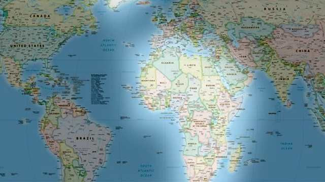
The United Nations General Assembly has overwhelmingly approved a proposal supporting a new world map designed to represent the actual relative size of the world’s continents more accurately.
The new map, known as the Equal Earth projection, gives Africa a significantly larger visual representation while making Europe and North America appear smaller compared with their portrayal on the traditional Mercator map.
In Friday’s vote, 164 member states supported the proposal, while the United States voted against it. Six countries abstained.
The UN resolution describes the Equal Earth projection as a more accurate and objective representation of the world’s landmasses and encourages member states to consider it as an alternative to the Mercator projection, created by Flemish cartographer Gerardus Mercator in 1569.
The Mercator projection was originally designed to help sailors navigate across the world’s oceans. However, because it projects the spherical Earth onto a flat surface, it significantly enlarges areas farther from the equator while making equatorial regions appear relatively smaller.
As a result, Greenland can appear almost as large as Africa on a Mercator map, despite Africa being roughly 14 times larger in reality. The projection also makes countries and regions such as the United States, Russia and Europe appear considerably larger than their actual land areas.
The Equal Earth projection was developed by a group of cartographers in 2018. It is designed to preserve the relative area of continents more accurately, making Africa, Latin America, South Asia and Oceania appear closer to their true proportions.
The US strongly opposed the UN initiative. US representative Yaryna Ferencevych criticised the proposal before the vote, arguing that the UN should focus on genuine global crises rather than what she described as debates over a centuries-old map projection and geographical politics.
Togo, a co-sponsor of the proposal, strongly backed the initiative. Foreign Minister Robert Dussey argued that maps do more than teach geography—they influence people’s imagination and shape how they understand the world.
Dussey also said that no map is completely neutral and that repeatedly presenting distorted geographical representations can reinforce misconceptions about different regions and peoples.
France also supported the proposal. French Foreign Minister Jean-Noël Barrot said changing a map would not change the world, but correcting distorted representations would be an important step toward presenting reality more accurately.
France’s support has also drawn attention because Paris has recently been seeking to rebuild political and diplomatic ties with several of its former African colonies. Analysts view its backing of the initiative as potentially part of a broader effort to strengthen relations with Africa.
Advertisement