১২ আষাঢ় ১৪৩৩


US Map Depicts Jammu and Kashmir as Part of India, Causing Diplomatic Unease for Pakistan and China
07 February 2026 19:02 PM
NEWS DESK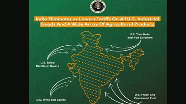
In a move that runs counter to Pakistan’s long-standing claims over Jammu and Kashmir, the United States has released a map showing the entire region as part of India. The map also depicts Aksai Chin as Indian territory, a development that has reportedly caused diplomatic discomfort for both Pakistan and China.
The map was released on Saturday as part of the announcement of a framework for an interim trade agreement with India. In the map published by the US side, Jammu and Kashmir is shown entirely within Indian territory, including the area currently under Pakistan’s control—commonly referred to as Pakistan-Occupied Kashmir (PoK). The disputed Aksai Chin region is also presented as part of India.
India has long maintained that Jammu and Kashmir is an integral part of its territory, while Pakistan claims parts of the region and has consistently raised the issue in various international forums.
New Delhi has also repeatedly accused Pakistan of supporting terrorism in the region, alleging that such actions have contributed to prolonged instability.
Analysts view the publication of the map as significant, noting that Washington has historically taken a more cautious and relatively neutral stance on the Kashmir issue. The decision to portray the entire region as part of India is being seen as a shift in the US position.
So far, Pakistan has not issued an official response, though the development is being actively discussed in diplomatic circles.


Comments Here: