২৫ চৈত্র ১৪৩২
Hurricane Erin: Fastest Rapidly Intensifying Storms in Atlantic History
17 August 2025 18:08 PM
NEWS DESK
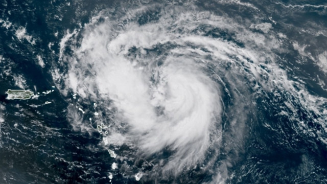
Powerful Hurricane Erin has undergone astonishingly rapid changes in its intensity — a phenomenon that has become far more common in recent years as the planet warms. It quickly became a rare Category 5 for a time Saturday, before weakening and becoming a larger system on Sunday as it churns through the Atlantic Ocean north of the Caribbean.
Erin went from a Category 1 hurricane with 75 mph winds at 11 a.m. Friday to a Category 5 with near 160 mph winds just over 24 hours later. It put Erin in the history books as one of the fastest-strengthening Atlantic hurricanes on record, and potentially the fastest intensification rate for any storm earlier than September 1.
Erin was still “a formidable Category 4 hurricane” late Saturday, the National Hurricane Center said. By 2 a.m ET Sunday, it had weakened further to a Category 3 hurricane while becoming a larger system, the Center said.
With maximum sustained winds near 125 mph and higher gusts, its hurricane-force winds now extend outward up to 25 miles from the center, and tropical-storm-force winds extend outward up to 205 miles.
It is forecast to return to Category 5 strength as it undergoes an eyewall replacement cycle, a process that will cause the storm’s windfield to grow.
Furthermore, Hurricane Erin is now one of only 43 Category 5 hurricanes on record in the Atlantic – which makes it rare, though not as rare in the context of recent hurricane seasons – as peak strength is becoming easier for storms to achieve. It is the 11th Category 5 hurricane recorded in the Atlantic since 2016, an unusually high number.
Hurricane Erin is still expected to avoid a direct hit on any land mass, passing north of Puerto Rico, then curving north-northeast into the open Atlantic between the East Coast and Bermuda next week. As it does so, it is expected to double or even triple in size.
The outer bands of the storm will continue to produce areas of heavy rainfall through Sunday across the northern Leeward Islands, the Virgin Islands, and Puerto Rico, the Hurricane Center said. Considerable flash flooding, landslides and mudslides, are possible, it added.
The storm is expected to produce life-threatening surf and rip currents along the beaches of the Bahamas, much of the US East Coast, and Atlantic Canada next week, according to the National Hurricane Center.
Fluctuations in intensity are expected for the rest of the weekend, as Erin brings rain and strong wind gusts to the Caribbean islands south of it. Erin is expected to persist until Monday, when it will start to slowly weaken.
Erin’s powerful wind field is forecast to at least double or triple in size next week, resulting in rough beach conditions on the East Coast.
The storm is passing just north of the Leeward Islands, the Virgin Islands and Puerto Rico this weekend while making a gradual turn toward the north. It’s unlikely it will make a direct landfall on any of the northeastern Caribbean islands, though tropical alerts are in place for some of these areas cautioning potential threats.
Erin is forecast to track north over the western Atlantic next week, away from the United States and Bermuda, but that could change if the storm turns more or less sharply than currently forecast. Even if the forecast remains consistent, Erin could cause issues for both places in the form of rough surf and dangerous rip currents.


Comments Here: